Enterprise Geospatial Data Exploration
Get a tailored analysis of your current geospatial datasets and an exploration of the data market. Request your data exploration »What is a Geospatial Data Exploration?
Data exploration is a service offered to businesses that are unsatisfied by their current data inventory, including external data. This service also applies for companies looking for new untapped data usage opportunities. The process involves understanding customer’s needs and assessing internal and external datasets for cost optimization and relevance analysis.
Deliverables consists of recommendations and cost estimates, both for external data acquisitions and for various possible integration options.
At the end of the project, customers will get all the information needed to make the most out of their internal and external geospatial data.
Why Should you Get a Data Exploration?
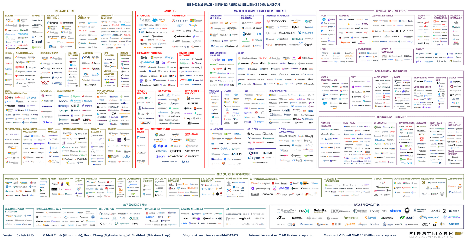
The availability and variety of geospatial datasets have drastically expanded. As shown on the image below, they include a multitude of commercial data providers, open source and governmental datasets, advanced types of data such as mobility-derived data, or derived data using imagery and AI.
With so many options, it can be challenging to compare datasets from different vendors and select those that truly meet your needs. Assessing the nuances of the geospatial data landscape can become a full-time job, requiring a dedicated team.
Moreover, advanced and massive datasets require a mix of technical skills, such as big data processing, and non-technical skills, as well as legal analysis and knowledge of data privacy regulations.
A common mistake organizations make is spending money on data without understanding the data landscape and lacking the expertise to process it and maximize its value.
That’s why geospatial data experts analyzing the market in line with your business objectives before making any decisions becomes essential. With Korem’s data exploration services, businesses can access the most relevant, high-quality data within their budget. This not only keeps them ahead of the competition, but also enables them to achieve their goals in a more effective way.

Source: FirstMark Capital
Consequences of Choosing the Wrong Data or Vendor
Loss of time (business disruption and delays)
Decreased future user adoption
Lost in revenue
Replacement costs
Benefits of Data Exploration
Maximize data usage
Identify new opportunities

Increase user adoption
Reduce time-to-value
Create long-term value for organizations
For the past 20+ years, I have built a tremendous in-depth knowledge of geospatial technologies and data and how they can benefit organizations. With a customer-centric approach and strong business acumen, I have helped key Fortune 500 customers disseminate our geospatial solutions across their organization. I am passionate about bringing the value of our solutions to our customers in order to improve their operations and bottom line.
Jean-Sébastien Turcotte
Vice President


What Will You Get From Korem’s Data Exploration?
STEP 1
Kick Off + Discovery Meeting
We’ll schedule a meeting to learn more about your geospatial challenges and business objectives.
In the meantime, you will provide Korem with an inventory of internal and external datasets used.
STEP 2
Analysis of Current Data
Korem will analyze your data inventory and identify gaps based on your company’s business goals. The goal is to get a holistic view and ensure the success of your objectives in the most efficient way.
In this inventory analysis, we’ll be on the lookout for unused data which isn’t necessary, ensuring that you only pay for the data you really need.
STEP 3
Exploration of New Datasets Aligned with Company Goals
With all the necessary information in hand, Korem will explore the data market to find and analyze the right products tailored to your specific needs.
With our extensive partner portfolio and our knowledge of the industry, we will advise on data options (including commercial and open-source datasets), explain the pros and cons and provide high-level pricing.
We simplify complex concepts and formalities, such as terms and conditions, ensuring the information is easy to understand.
STEP 4
Summary and Recommendations
Korem will present a data exploration report, including:
- A summary of the business objectives, the internal and external datasets already used
- A comprehensive list of external data explored, including: Costs and pricing models, possible integration scenarios (DaaS), terms of use and licensing constraints
- Data analysis results
- Conclusion and acquisition recommendations
- Possible scenarios for next steps, like a pilot project supported or carried out by Korem.
Why Korem?
Choosing the right geospatial partner can be challenging.
Most software vendors and system integrators either have limited expertise in geospatial technologies or are only specialized in one technology, forcing you to contact with multiple vendors.
As geospatial experts, Korem is constantly monitoring the market, performing analysis and benchmark to compare the data and provide our clients with the best solutions for their needs.
Since 1993, we’ve partnered with over 15 geospatial leaders to offer our customers the largest portfolio of word-class products.
Our advisors and experts work for you, providing vendor-agnostic and neutral recommendations.
We are certified ISO 27001
Data security and confidentiality have always been our top priority. Our ISO 27001 certification testifies our commitment to the highest security standards, stating that we meet the requirements for establishing, implementing, maintaining and continually improving a structured information security management system.

Ready to Start Your Data Exploration?
Give us your information and we will contact you to start your data exploration.


